


@Round: this is where we take you cycling ...
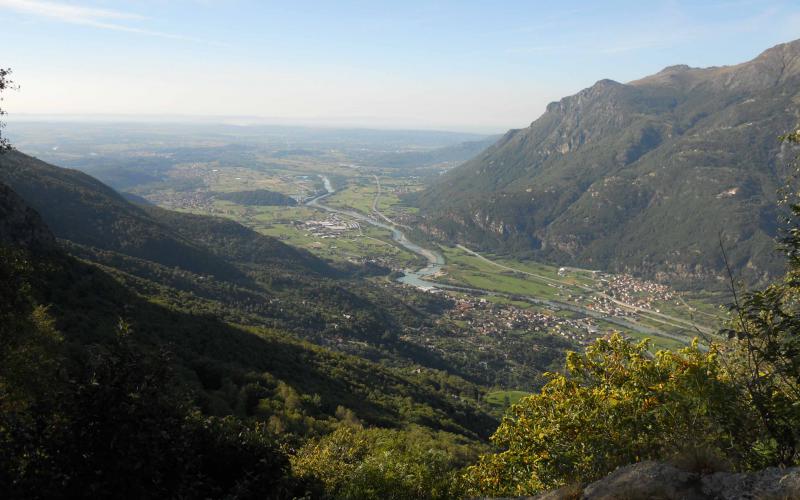
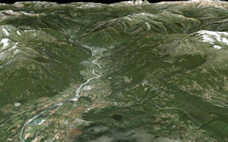
Between Ivrea and Biella is the hilly area of the Ivrea Morainic Amphitheatre, one of the most important natural amphitheatres in Italy, the distinctive feature of which is the flank of the basin (the hill in particular) rather than the lacustral basin contained in the glacial trough, as in the case of Lakes Maggiore and Garda.
The amphitheatre is made up of various different geological or landscape features: the hills, the Ivrea plain, rocky outcrops in the plain and alluvial areas outside the moraine trough.
There are three main sectors in the moraine circle, each with its own distinguishing natural and anthropic features:
-the left-hand orographic flank called the Serra d’Ivrea (from the village of Andrate to Lake Viverone);
- the front lobe (from Lake Viverone to the Valchiusella channel) divided into the east front lobe and the west front lobe by the Dora Baltea fracture near the village of Mazzè);
- the right-hand orographic flank known as the Valchiusella Moraine (being the left side of the lower part of Valchiusella).
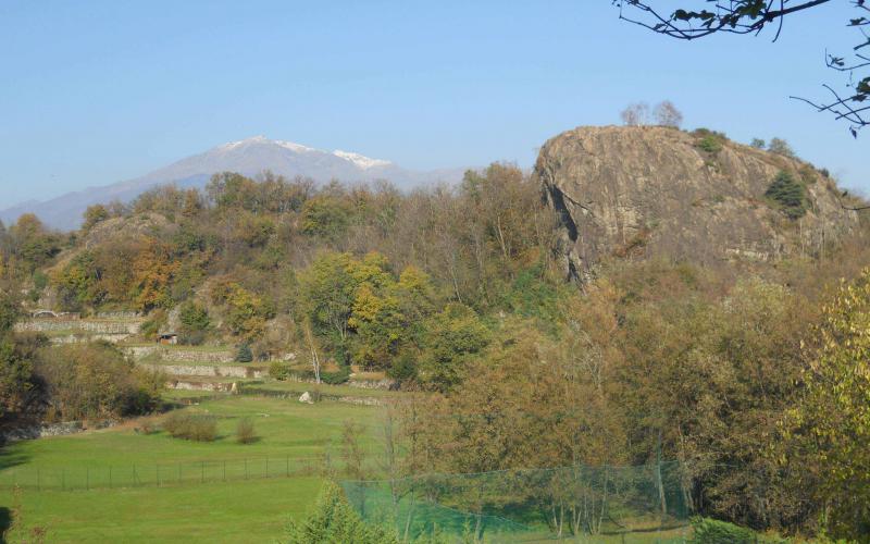
The first one, consisting of the steep, wooded Serra bastion, a straight line towards the north-west, and the others with their more irregular, fragmented profiles, together make up the continuous circle of the morainic system. In the north-eastern part of the amphitheatre, north of the city of Ivrea, are the rocky hills, one of the rare outcrops of basic granulite in the world. The morainic arcs between Romano Canavese and Strambino, Azeglio and Albiano,and the Montebuono at Borgofranco d’Ivrea are, on the other hand, discontinuously dotted around the Ivrea plain.
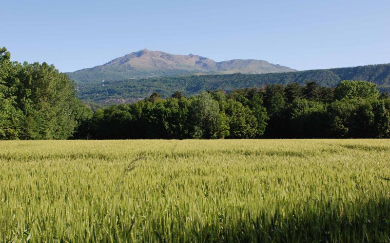
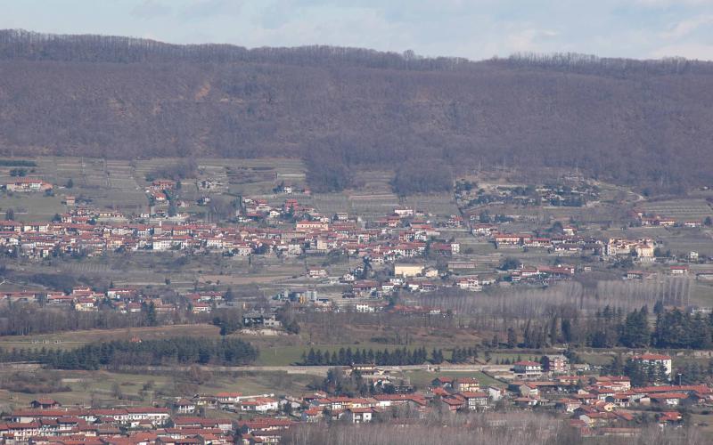
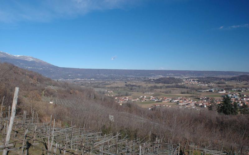
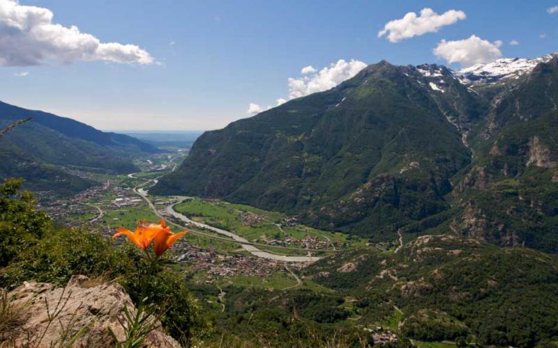
The central plain, consisting of ancient and more recent alluvial deposits, is crossed from north to south by the furrow of the Dora Baltea river, and from west to east by the Chiusella river, which divide the right from the left-hand side and the northern area with its rocky outcrops, typical of narrow valley bottoms, from the southern area with the typical features of a wide plain where farming is mechanized. Here only traces can be found of the most common element of the other amphitheatres in Italy – that is, the lacustral basin contained in the morainic trough – while greater significance is attributed to the pattern of the overall structure and of the flanks.
The mountain reliefs
North of the system, on the right-hand side looking toward the mouth of the Aosta Valley, is the Mombarone/Monte Torretta system against the backdrop of the “Biellese” mountains (Camino and Mucrone) and on the left-hand side Monte Gregorio and the Cavallaria, with its distinctive saddle that in the background leads up to the Bella Addormentata (Sleeping Beauty).
The crest of the Serra
The left orographic border of the moraine that starts at 900 m. above sea level from the slopes of Mombarone tapers off into the hills around Lake Viverone at around 300 m. above sea level, creating a continuous straight ridge that completely blocks the line of vision to the north west.
The morainic hills
Towards west/south west the outline of the moraine is more fragmented and irregular, with a succession of wooded slopes that still, however, give the perception of the continuity of the circular morainic system, which ends as it merges into the foothills that give rise to the Valchiusella.
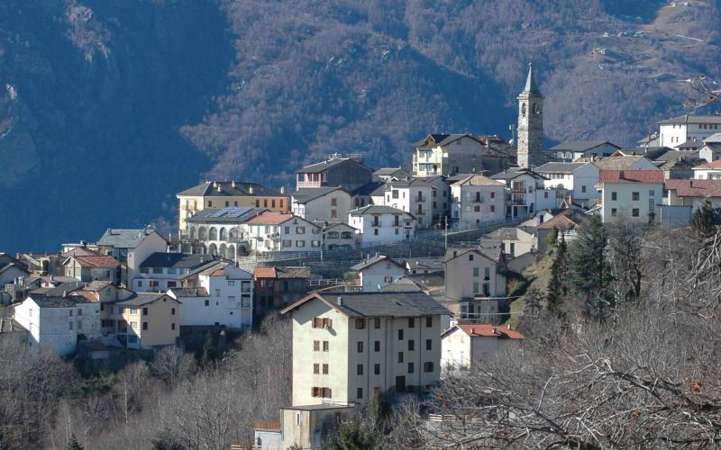
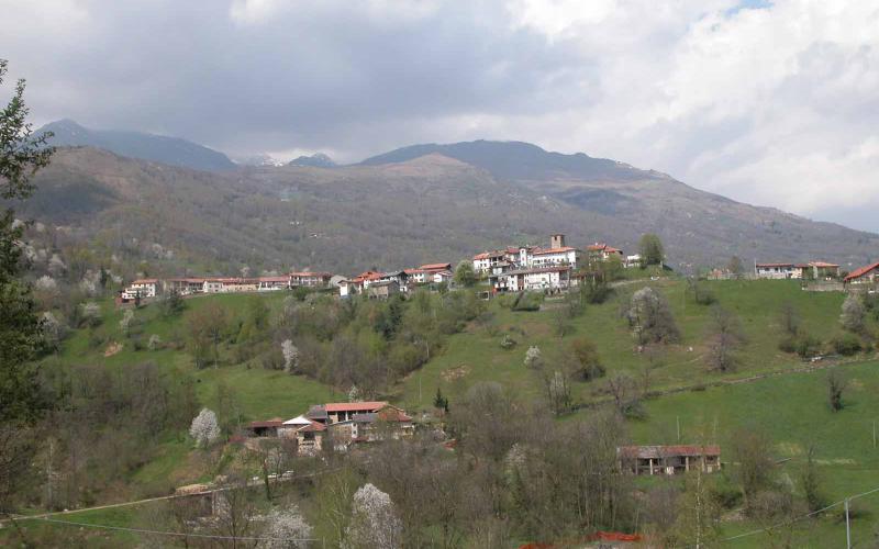
The hill villages
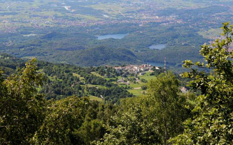
From the steep wooded Serra bastion, the higher villages such as Andrate (about 800 m.above sea level), Chiaverano, Burolo and Piverone (350 m. above sea level) look down. On the front lobe and on the right-hand side of the morainic system are the villages of Albiano, (only parts of which on high ground) and Azeglio, guarded over by their castles, Settimo Rottaro, Caravino, and further back Scarmagno and San Martino.
Villages and isolated buildings in commanding positions
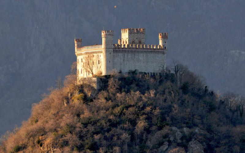
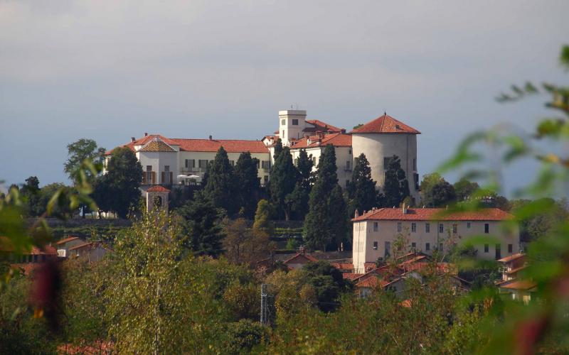
In an exceptional position on the ridge of the front lobe of the moraine, at the point of the gap where the river Dora Baltea leaves the morainic amphitheatre, is Masino castle at 300 m. above sea level, overlooking the plain from Masino village, towering above Caravino.
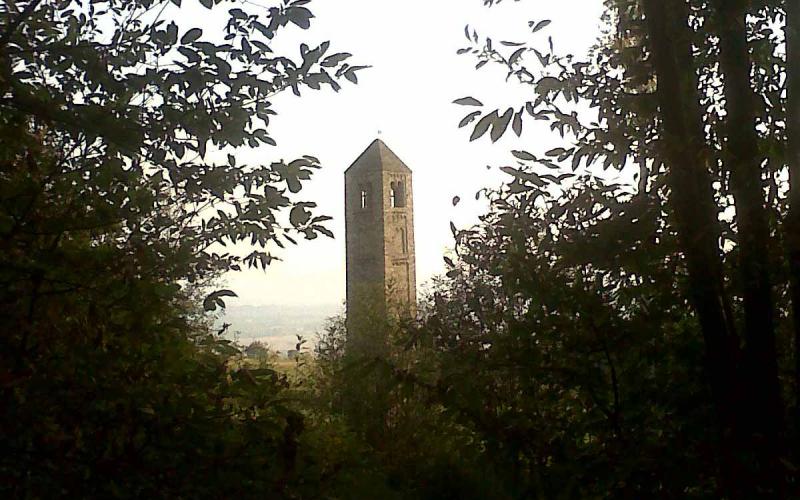
The Romanesque belltower of San Martino (400 m. above sea level) in the ancient village of Perno (Bollengo), commonly known as the Ciucarun, stands out on the Serra hillside, while on the crest in the Broglina area at 550 m. above sea level is a telecommunications pylon and further down, above Bollengo village, looms the Bishop’s castle.
Finally, Montalto Castle at 340 m. above sea level on the dioritic outcrops that border Ivrea to the north.
The right-hand morain faces Brosso church, at 790 m. of altitude high up on a balcony overlooking the mouth of the Aosta Valley; towards the Upper Canavese area, the church and the flat terrain at Santa Elisabetta, from an altitude of 1200 m. above sea level survey the towns and villages of the Valle Sacra mountain community above Castellamonte.
The agricultural plain
The countryside in the plain is quite uniform as regards its morphology, vegetation, human settlements and historical-cultural features. There are still some signs of ancient roads and land segmentation (centuratio Eporediae), being on the route of the Imperial road to Eporedia (Ivrea). The land is mainly used for arable farming.
Over the centuries, man’s work has styled the agricultural landscape, that marks the territory with a regular geometry of fields, rows of vines, canals, roads and farmhouses with villages here and there. It is generally possible to make out the course of the canals and irrigation ditches between the plots from the type of planting or from the thickening of the vegetation. The naturally wooded areas along the riverbanks are precious to the scenery also giving a break from the agricultural landscape with its villages.
The most important road infrastructures (the TO – AO motorway, the Santhià - Ivrea motorway link road and the SS26) have a significant impact on the plain, interrupting the continuity of the flat areas and scarring the hilly area near Sapel da Mur (Azeglio) and Pietragrossa (Scarmagno).
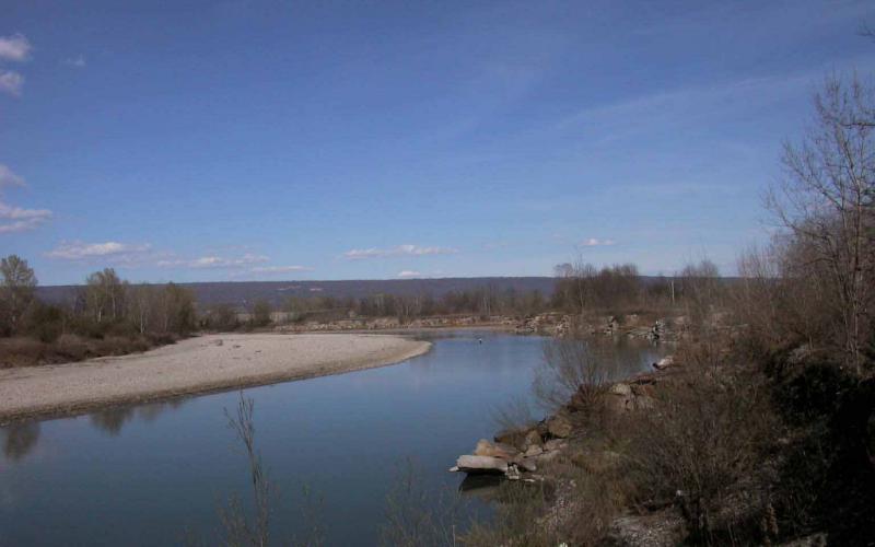
Another break in the landscape, running right across from north to south, is the river Dora.
A considerable number of gravel quarries can also be noted, in particular straddling the river Dora and the Palazzo Canavese plain, which often become landmarks. Many of them are still in use, others are abandoned; in a few rare cases the areas have been reclaimed and when this happens the quarries are often turned into small artificial lakes.
The most important keys to the history and culture of the area are the farmhouses that testify to the agricultural past and have a distinctive local style.
Lakes
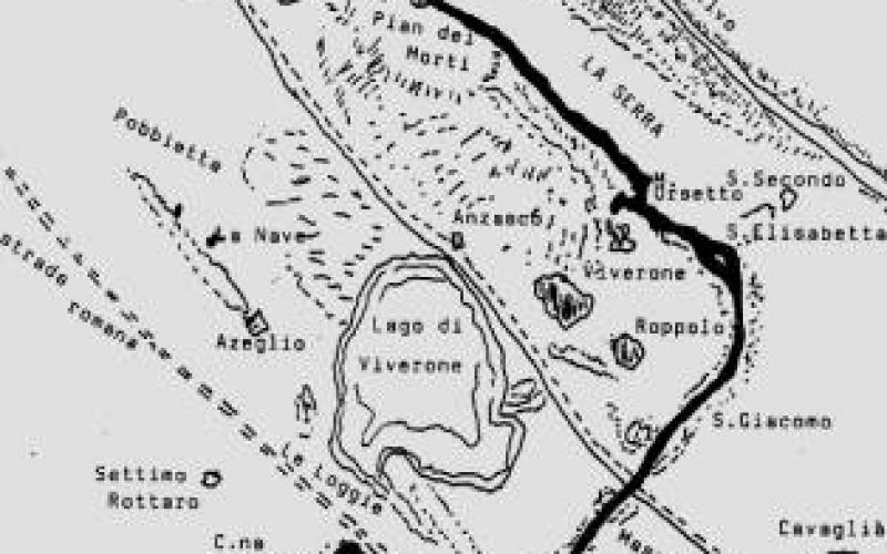
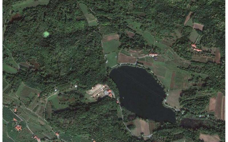
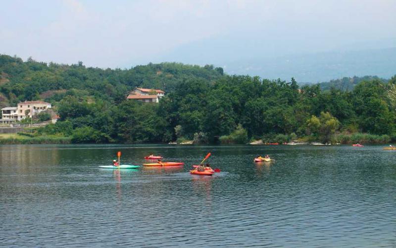
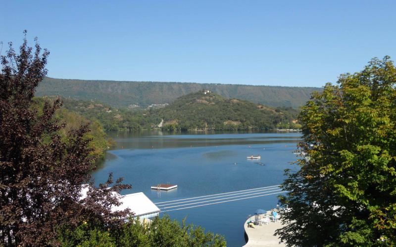
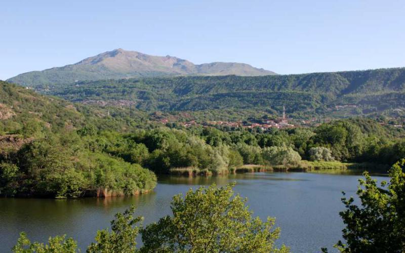
Lake Viverone (Lagh ëd Vivron in dialect) is the third largest lake in the Piedmont Region and is situated in the southern part of the Biella Province, bordering on the Turin Province. It is a lake of glacial origin, which formed during the quaternary age (as did many of the lakes close to the Alps), with many underground streams flowing into and out of the lake. Apart from being important for tourism and for its fish, Lake Viverone is an important archaeological site for Bronze Age prehistoric remains. In 2005 it was acknowledged as a site of community interest (code: IT1110020).
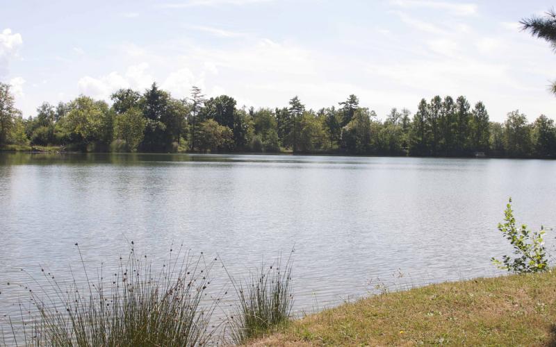
Lake Candia, situated at Candia in the Canavese area about thirty kilometres from Turin, is the last unspoilt lacustrian basin in the Po Valley in Piedmont, before reaching the Western Alps mountain barrier.
This makes it particularly critical as a wetland for the birds, especially during migration and the winter months.
Since 1995, the lake and the surrounding area have been protected as a Provincial Nature Park and for this reason hunting and shooting are prohibited. Licence-holders are allowed to fish for just a few types of fish. The Lake Candia Nature Park was the first Italian Provincial Park to be set up and covers an area of 336.17 hectares in the province of Turin.[1]
In addition to this form of protection, in 2009 Candia Lake was also recognised as a site of community interest (code: IT1110036).
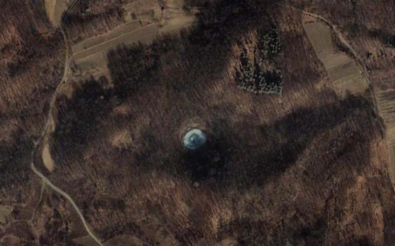
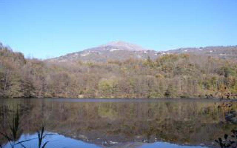
Situated on the border between Ivrea and Chiaverano Local Governments in olden times it used to be known as San Giuseppe after the name of the convent on the top of the mound overlooking the lake. It has an area of about 0.3 square kilometres and a depth of almost 45 metres, and is the only one to be spring-fed. Surrounded by an alder wood, it is the ideal habitat for many species of plants and animals typical of aquatic environments, such as mallards, moorhens, frogs and tree frogs.
It is situated in a hollow carved out by the retreating Pleistocene glacier, which also gave rise to the other four lakes in the area (Sirio, Nero, Campagna and San Michele). Today Lake Pistono is fed by the Rio Montesino, while on the extreme west side there is an artificial canal, built to take water to what used to be the village mill. The outflow of water is regulated by a small dam. A path runs between the lake and the trees right around the lake. On the north side, on the top of the hill towers the Castle of Montalto Dora, reflected in the lake below.
Lake Nero lies among the green woods in the municipality of Montalto Dora (TO).
It is the most remote and unspoilt lake in the Ivrea area; set among the steep thickly-wooded hills it evokes scenes of battles and ambushes.
Lake Nero is fed by rainwater and by two streams flowing in from the north, while the emissary is to the west in the direction of Borgofranco.
A small island emerges from the water, right in the southern area when Mombarone is reflected majestically in the lake. The lake is in the middle of the countryside, with dense vegetation all around, making the colour of the water particularly dark, hence the name.
This is the smallest of the Five Lakes of the Ivrea Serra and fills a rocky hollow of glacial origin. From the shore the land rises steeply to a scenic promontory, from which you can reach the 11th century church of the Three Kings.
Castles
The Canavese Castles circuit consists of an assortment of ancient manor houses and castles – testimonies to a history reaching far into the past, often marked by revolts of the people and civil wars – found throughout a large part of the Canavese area, in Piedmont.[1] Previously they were aristocratic family homes, while now many of them are used as museum centres (managed either privately or publicly); some house public offices, in particular town halls; others are used as accommodation for èlite tourism in an area full of places to visit, and of localities (Ivrea Morainic Serra, Lake Viverone) of interest for their natural environment and fauna (birdwatching and shooting) and food and wine (Erbaluce di Caluso and Piedmontese cooking). The best known are Ivrea Castle, the Duke’s Palace at Agliè and Masino Castle.
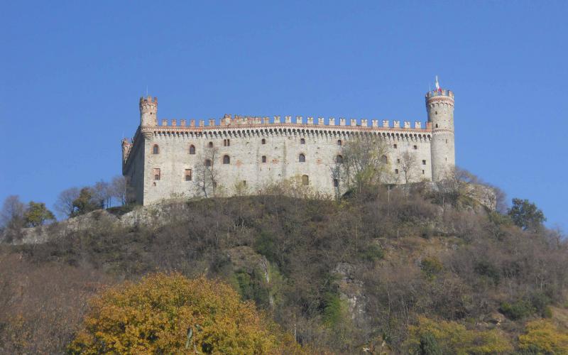
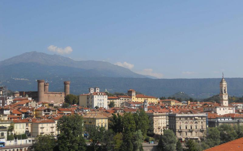
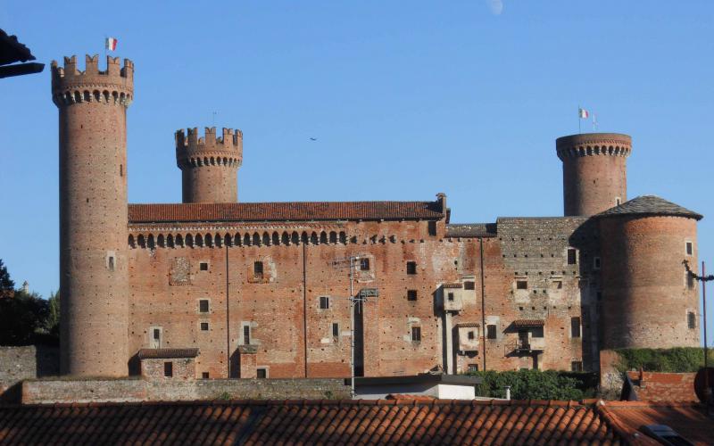
Situated in the high part of the city, Ivrea Castle – also known as the castle of the red towers – is an imposing construction built for defence in 1358 by the so-called Green Count, Amedeus VI of Savoy. It was built among the main Medieval-style seats of political and religious power: the Epsicopal Chapter, the Town Hall and the Cathedral. The tower of the keep was badly damaged in 1676 (and since then only the stump has remained) when struck by lightning during a terrible storm that assailed the city, causing an explosion inside the castle and the death of several people, as well as damage to the fort.
In later years it underwent considerable alterations and was used from 1750 to 1970 as a prison. With a very clean architectural style, the castle ramparts are still visible, where the watch patrolled to defend the castle against invaders. The Savoy coat of arms can be seen above a two-light mullioned window with trilobed arches.
Masino Castle, at Caravino, was the main residence of the Valperga counts, an ancient Canavese family, and until Renaissance times was defended by a high wall and imposing watchtowers that were later demolished to make way for the splendid romantic monumental gardens, typical of Italian aristocratic homes. The whole building is literally covered with frescos, full of finely-made furniture and houses a museum of 18th century coaches that is absolutely amazing. At present the castle is managed by the Italian Fondo per l'Ambiente.
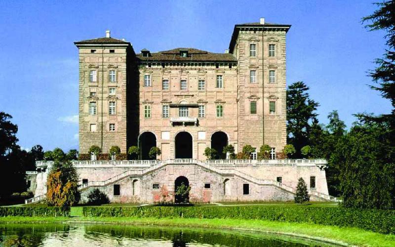
The Duke’s castle is a majestic, elegant building located at Agliè, in Turin province. Building of the central part, of which traces can still be seen, started in the 12th century for the family of the Counts of San Martino, who originated from the Canavese. In 1939 the state bought the castle from the Royal House and made it into a museum. In the 1980s it was slightly refurbished and at present major consolidation and renovation work is going on which means that many of the rooms cannot be visited.
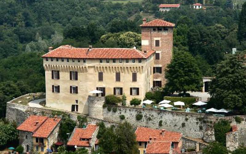
Mazzè Castle, now a private museum, was built very close to the course of the Dora Baltea on the remains of an old Roman fort, soaring above the Po valley in an area with abundant wildlife, and over the centuries was added to and refurbished many times. The most important changes, in Gothic style, were done by the architect Velati Bellini in the 19th century. There are three types of tour to choose from: the Grand Castle (twelve rooms), the underground museum (with dungeons, instruments of torture and a mortuary chapel) and the adjacent Park.
Pavone Castle (where historical re-enactments take place), now a hotel and congress centre, was originally a fort at the hub of various walled villages in a hilly area, under the jurisdiction of the Bishop of Ivrea. It was built between the 9th and 11th century. As in the other manor houses in the Canavese area, the most famous character recalled here is Arduino, King of Medieval Italy. In this case, the sovreign’s name is used to describe the coffered ceilings that decorates the inside of the castle. There are portraits of famous people and pictures of animals. Inside the castle, on the side of the courtyard, is a small church from the same period as the original building.
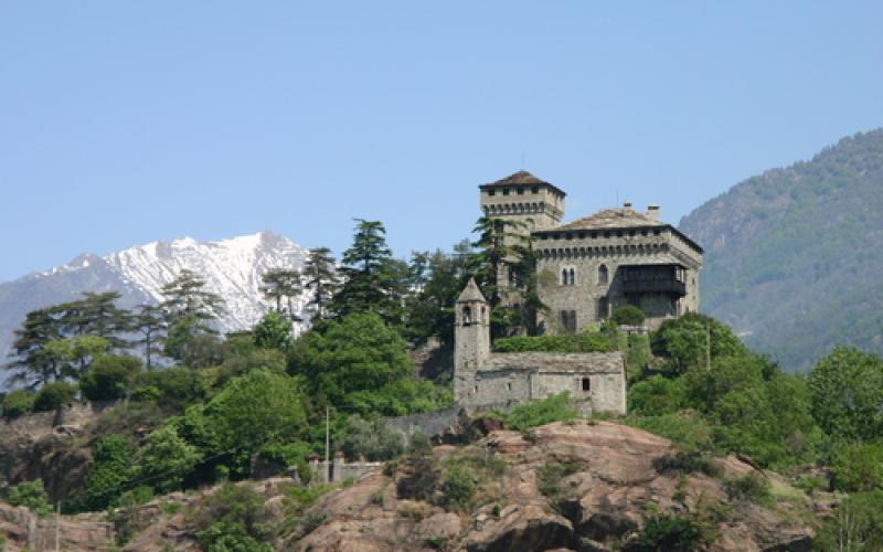
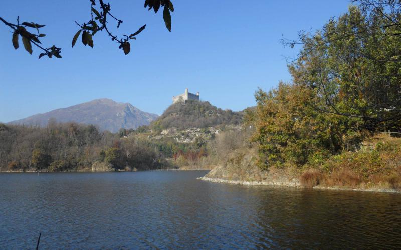
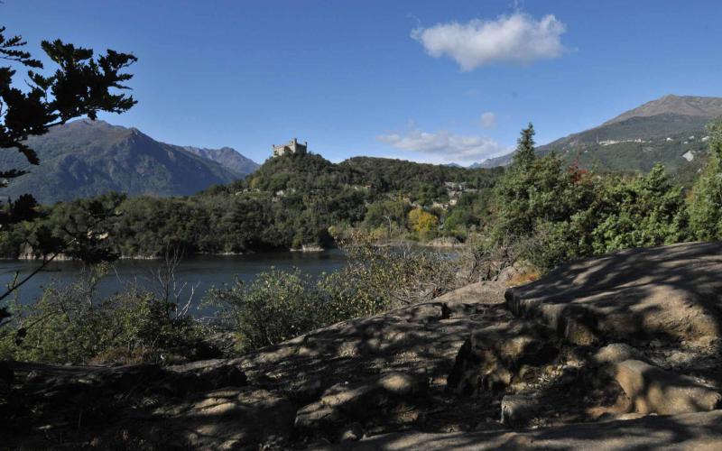
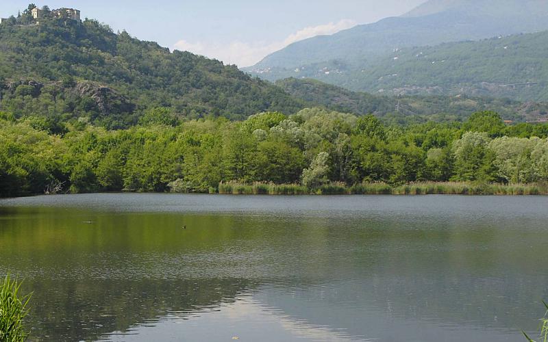
Montalto Dora Castle, at 405 meters of altitude on Monte Crovero at Montalto Dora, dates from the mid 12th century. However, over the centuries it was destroyed, rebuilt and refurbished several times, until in 1890 it took on the appearance that it has retained more or less till today, following renovation by Alfredo d'Andrade. Now privately owned, the castle is an integral part of the Roman village over which it towers, with a square irregular layout and double surrounding walls. Another tower dominates the inner part around the keep, the adjoining chapel, the rooms, some of which can be visited, and the battlements. In olden times it acted as a fortress to guard over the Ivrea plain leading to the Aosta Valley.
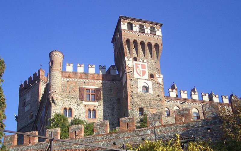
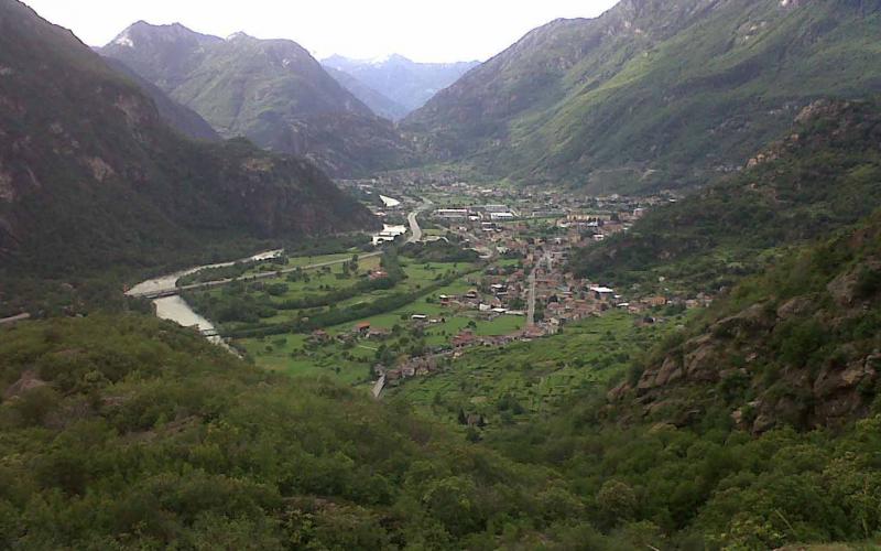
Settimo Vittone is a village of 1,600 inhabitants lying on the pre-Alpine slopes at the gateway to the Aosta Valley and just a few steps from Europe. The municipality of Settimo Vittone also includes several hamlets separate from the main village: Cesnola, Cornaley, Montestrutto and Torredaniele. The last hamlet in the valley bottom is Montestrutto, once a municipality in its own right. Its houses cling to the rocky mound that overhangs the Dora, almost making it impossible to skirt it (hence the old name Mons Obstructus). On the top of the mound is a castle, rebuilt in Neogothic style. The church of San Giacomo that can be seen just below it is, however, Romanesque.
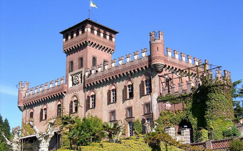
About 2 km from Lake Viverone, from the external terrace of the castle there is a wonderful view over the whole of the lake, clearly visible past the lovely terracotta roofs of the village. The castle was already mentioned in the 10th century in a diploma of Otto I (936 A.D.). The base of the present-day tower was the first fortification built, originally of wood, with foundations of granite blocks, around which the castle was later developed in the 13th century, after the Bichieri of Vercelli got the better of the decadent Counts of Cavaglià. The castle remained in the possession of the Bichieri family for two hundred years, until it passed into the hands of the Savoy house in 1407, then in 1441 it passed to the Valpergas of Masino, who held it until the French revolution broke out. In 1800, the inside wall of the third room of the tower crumbled, bringing to light a complete set of armour and the remains of the body of Bernardo di Mazzè, a warrior walled up live by Ludovico, the lord of Roppolo. Alterations were made to the castle up to the last century and at present it houses the Serra Regional Wine Centre, the only one of its kind in Northern Piedmont, founded in 1981 and with an adjoining restaurant.
Churches
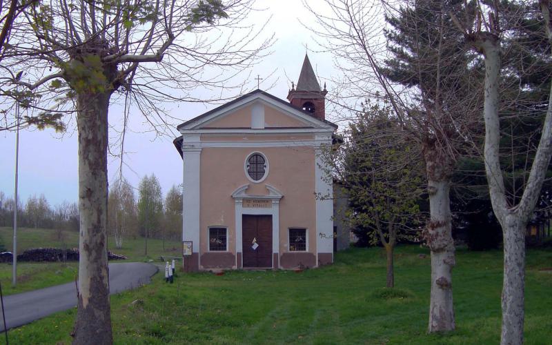
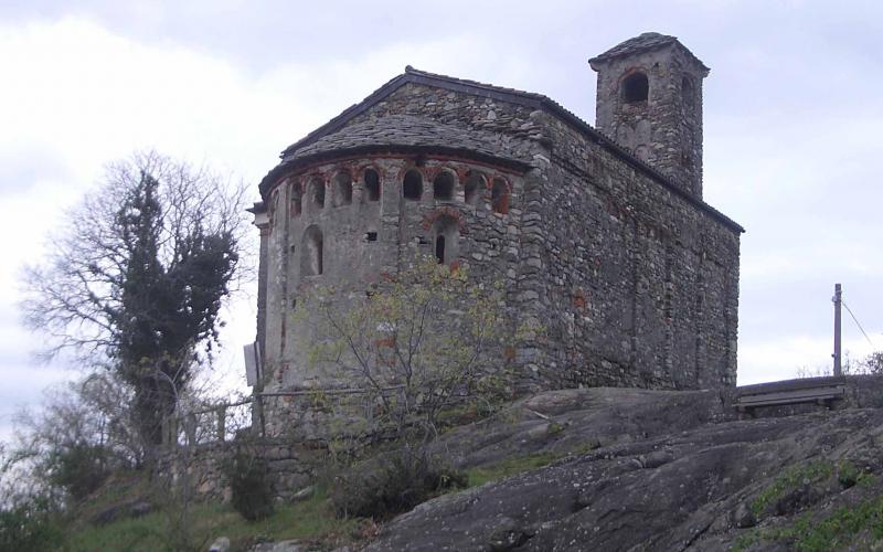
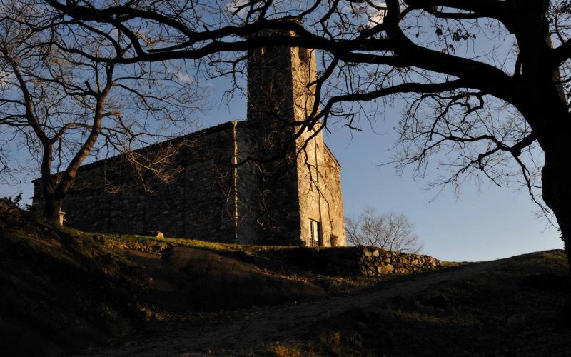
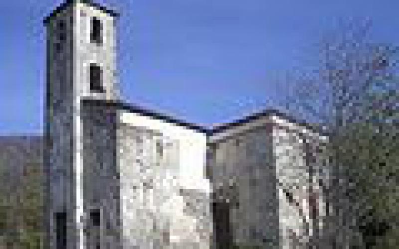
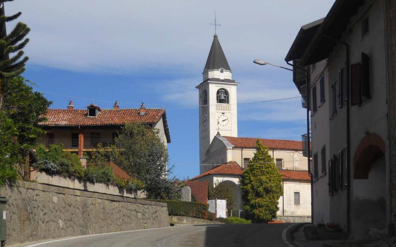
The little Romenesque church dedicated to Saint Stephen ("Sancti Stephani de Sexano") stands in an isolated place where there was once the village of Sessano, in quite an evocative area with huge dioritic rocks breaking the surface and, in the background, the woods that cover the slopes of the Ivrea Morainic Amphitheatre. In addition to restoring the ancient place of worship, the Chiaverano village council has paid for the surrounding area to be improved, also making a medicinal herb garden [1] Built in the 11th century, the church was where the inhabitants of the old village of Sessano worshiped until it became depopulated already in the 13th century[2]. Observing the church from the façade, it is easy to see the three architectural elements of the building, the single nave with a roof made of wood trusses, the belltower which affords access to the church and, on the south side, the rectangular sacristy added in relatively recent times (certainly after 1782[3]. The solution of the clocher porche, that is to say the bell tower placed on the façade with a type of porch which gives access to the inside of the church, is rather uncommon in Italy, although there are many examples in the Romanesque architecture of the Canavese (similar solutions can be found at Settimo Vittone, Bollengo, Pecco and Lugnacco). The walls are built of local stone, roughly worked, with a few inserts in brick. From the outside, the lovely apse can be seen with its four pilasters that split the half-cylinder into three parts, each one with a double-splay single light; above these is a series of blind niches, four for each part, surmounted by brickwork arches. Between the niches and the semiconical roof of the apse (mad of "lose", thin slabs of stone) runs a saw-tooth brick cornice. Inside the church it can be seen that the building consists of three bays, the last one corresponding to the presbytery. The nave (6 metres wide and 15 long) is covered by a wooden truss roof, while the presbytery accessed by passing through the triumphal arch has a rectangular cross vault. The semicircular walls of the apse show the remains of ancient Romanesque frescos.
The village of San Vitale may have formed after the disappearance of the ancient village of Pavarano. The parish church stores the skull of the saint from Ravenna venerated by the inhabitants of San Germano Vercellese who, afflicted by terrible wars in 1613, turned to him promising to hold a yearly procession at Roppolo if they were freed, which they did. The skull of the saint was stolen with the silver statue in 1747 and was miraculously refound on 26th December, the feast of the other patron of Roppolo, Saint Stephen.
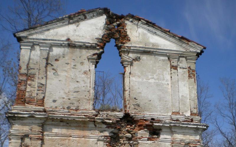
Standing on the morainic crest that is the backdrop of the village of Zimone, the 12th century church, even though a national monument, is in a very bad state of repair. From the flat area in front of it there is a lovely view of the village.
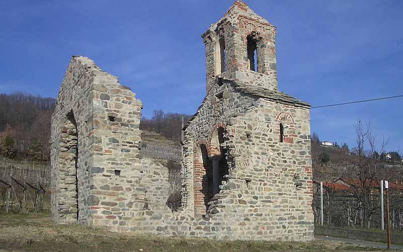
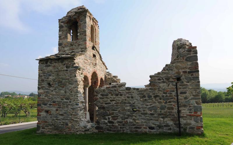
“Gesiun” is the name given by the inhabitants to the ruin of the church dedicated to Saint Peter, at Sugliaco, on the border between the municipality of Piverone and Zimone. It is in early Romanesque style and probably dates from the 9th century, the only one of its kind in the whole of Piedmont.
A sturdy building made of stone, it has two columns with cubic capitals that support the arches of the small presbytery, made of two rough stone steles, perhaps at one time with some type of cladding to make them cylindrical.
The area of the presbytery is thus separated by the three arches, the two columns and a low side wall, which according to some scholars recalls certain Longobard and Byzantine churches.
The part of the presbytery, with sides 3.80 x 1 m, is remarkable with its sail vault and rectangular opening in the centre through which a ladder gave access to climb the bell tower, with four windows crowned by a small cornice and semicircular terracotta arches.
Prehistorical traces
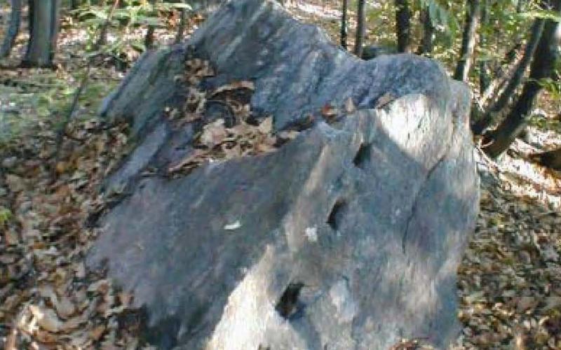
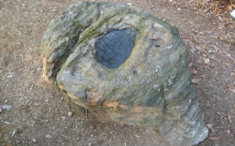
This is a hollowed out stone with various depressions of different sizes on the surface (cupels). It lies at Lusenta (from Lug, the Celts’ sun god, or from lucus, Roman sacred wood), in a wood of oak and chestnut trees in the Borgomasino municipality, on the south ridge of the hill on which Masino Castle stands. Although already known for its curious engravings, it was first described as an altar stone when discovered by Professor P. Baroncelli in 1925.
The stone has a vaguely cylindrical shape, with a diameter of about two metres and an average height of 60 cm. The inside has a large oval hollow with the longest side about 90 cm. The cupels are situated in the south-west parts of the stone, which from the ergonomic viewpoint are the easiest areas to access for anyone who wants to so “something” on the surface of the rock or in the central trough. The cupels are at different heights and any liquids would always flow in the same direction. The size and form of the engravings on the Pera Cunca were related to a specific ritual function.
Recent theories argue that the Pera Cunca was an altar stone used by the Celts to celebrate the feast of Imbloc, but also a perfect astronomical machine able to find the position of the heliac rising of the Capella star (The Goat) in the Auriga constellation, the direction of the sun’s orbit and, perhaps, also act as a calendar.
The quarry is a natural circular depression, about 60 metres in diameter, near Lake Bertignano, regularly flooded by stagnant water, containing heaps of stones, disturbed by gravel-extracting excavators in the past, and fragments of pottery testifying to a ancient pile settlement.
The site is of archaeological interest. It was the location of a prehistoric pile settlement, consisting of dwellings built on twelve large heaps of pebbles, still present today. In fact, excavations at the site have brought t o light pottery from different periods, Neolithic and Bronze Age.
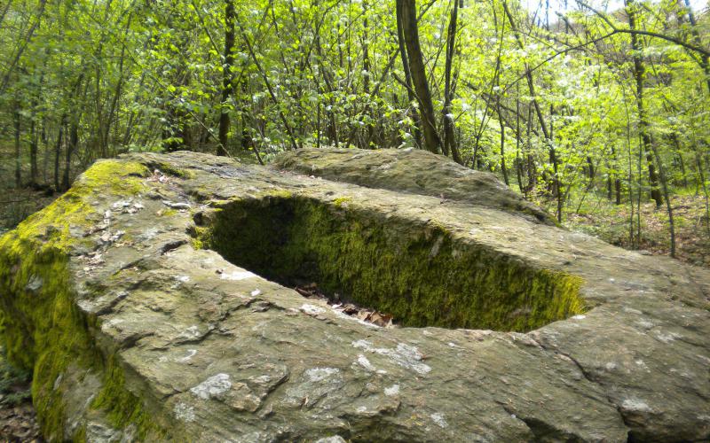
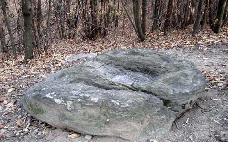
This is a huge erratic boulder 720 m long, 3.25 m wide and 1.25 m high, with a carved out regularly shaped sarcophagus (1.80 x 0.75 x 0.45 m) surrounded by seven cupules of various sizes, where it is believed that the Queen (the Virgin Mary) placed her thimble, scissors and thread which, when filled with rainwater, cured ailments of the women who bathed in it.
Ancient pagan rites, which only later become Christianized, were celebrated at that rock, said to be the burial place of a “Barbarian Queen”.
This is a small lake on the Serra, just north of the town of Viverone, in an area landmarked by electricity pylons left over from the hydroelectric power station that worked there in the early 1900s.
The lake is an important archaeological site for the finding of two piroga canoes dug out from a single chestnut tree trunk, each with two oars. The first was found in 1912 and is 4.1 m long, 30 cm high and 50 cm wide. The second was found in 1979 but was only removed from the mud in 1982; it is 3.75 m long, 90 cm wide and 60 cm high.
They were dated as being respectively from 250 A.D. and 1450 B.C., testifying to the existence of a lake dwelling settlement that may have been long- or short-lived, confirmed by the presence of fragments of pottery and ceramics.
Lake Viverone is an important archaeological site, the remains of Bronze Age lake dwellings (300-900 B.C.) having been found on its bed.
Two villages from the middle and late Bronze Age were discovered in the north-western part of the lake: St. Anthony and Emissary. The former consists of a few hundred piles, while the latter, much much bigger and consisting of thousands of piles, presumably covered an area of 5000 square metres. This settlement, with an estimated population of about 1,000 inhabitants, can rightly be considered equivalent to a large city in the second millennium before Christ.
The lake, which adjoins the provinces of Biella, Turin and Vercelli, covers 56 Km2 and has a perimeter of 10 kilometres and an average depth of 20 metres, reaching 80 metres in some places. In 2005 it was acknowledged as a site of community interest (code: IT1110020).
Ducks, mallards, coots, grebes and gulls are the main birds found there, while the lake teems with whitefish, perch, carp, tench, pike and catfish.
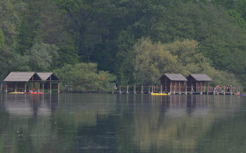
Boats rides connect the lake ports of the Lido, Masseria, Comuna, Anzasco and Azeglio.
Viverone is a focal point for tours in the Biellese, Vercellese, Canavese and Aosta Valley areas but, more importantly, the Via Francigena passes right through it.
Towers ans fortifications
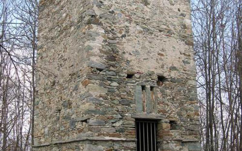
Saint Lawrence’s tower as you see if today is a 17th century reconstruction on the remains of a Medieval watch tower, perhaps belonging to a fortification of the former site of Saint Lawrence of Pavarano, now disappeared, which dates from much further back, from the time of the Lombards. Built on the edge of the comunal area of Salussola, it is situated in a high wooded area on the hill, bordering with Roppolo comune.
The setting of many bloody battles on the road that connected the Biellese, Vercellese and Canavese areas, for centuries the tower was one of the main lookouts on the southern foothills of the Serra.
It was also used during the last war and is today a trig point for the Italian Army.
This is a hill on the eastern part of the Ivrea Morainic Serra, in a wooded area between Bertignano Lake, near Viverone, and Peverano di Roppolo, in Biella Province.
It is the highest point on the south part of the Serra (452 m above sea level). Although it has never been investigated thoroughly, sporadic surveys and excavations over the last ten years have shown that it has considerable archaeological interest, bringing to light the remains of an imposing enclosure, known as the "castelliere"(fort), at different levels from the slopes to the peak.
The fact that the name of "castelliere" was given to the remains uncovered (walls, remains of huts) depends on the presumed analogy with some Celtic forts in Europe, fortified settlements placed in strategic positions on the top of rises or hills. Actually, given our present state of knowledge, there is no certain proof to substantiate the hypothesis that the buildings were from the Iron Age, since the material found only establishes that the site was frequented in the Middle Ages.
Walking up Monte Orsetto, it is easy to make out the double wall that surrounds three quarters of the summit consisting of a levelled embankment, on which there is an enormous erratic mass and a “magic” stone sunken into the ground, probably at that time surrounded by a palisade. These are evident traces of the old fort, perhaps pre-Roman, later possibly stronghold of the Lombard enclosures.
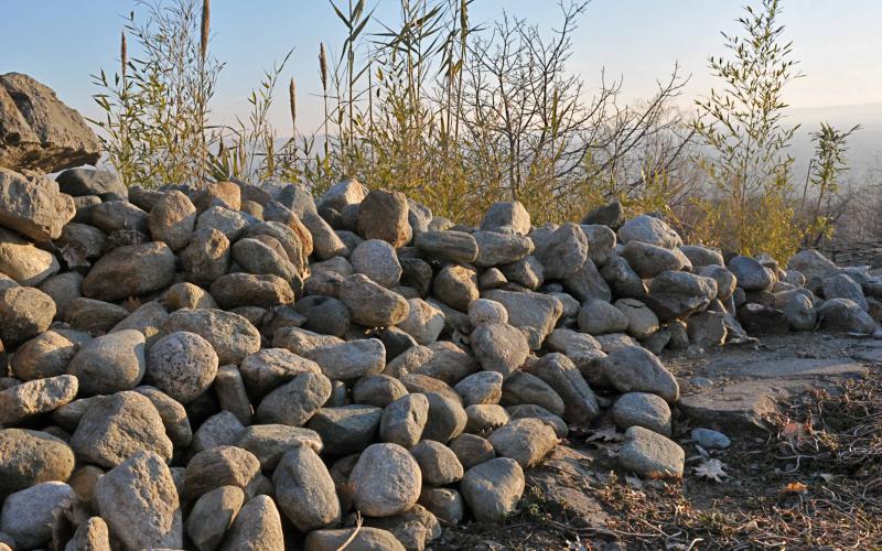
It is thought that on the high part of the Morainic Amphitheatre, on the stretch that goes from the Dora Baltea to the crest of the Serra, there must have been a great wall of defence, part of the so-called “Lombard Enclosures”, built by Desiderio in order to block the road to the Po Valley for the armies of Charlemagne approaching from the Aosta and Susa valleys. It is documented in the “Chronicon Imaginis Mundi ”, written in 1300 by Fra’ Jacopo d’Acqui, according to whom the decisive battle took place right next to the Serra and the defences were dry stone walls, made of “large and small stones”, piled up like rubble. In addition, the discovery of some warriors’ tombs testifies to the presence of Lombards east of the lake. Following the varying amounts of remains, it can be deduced that it continued for about thirty kilometres: from Zimone it went on to Monte Orsetto and near S.Elisabetta it provided the stones of the “Maserassa”, it closed off the Sapel da Mur pass and, skirting the Bric delle Barricate, reached the Dora, which was not crossed by bridges until Ivrea.
Open air museums
Inaugurated on 29th September 2001, the MAAM (Open air Museum of Modern Architecture) in Ivrea extends for 2km on a route along Via Jervis and in the adjoining areas containing the most significant buildings of the Olivetti era. The exhibits in the collection are buildings in modern and rationalist architectural style. At intervals along the public pedestrian routes that connect the buildings, there are seven groups of panels providing information, arranged so as to outline a possible tour itinerary and fitting in well with the city surroundings. The topics dealt with concern events related to Olivetti’s commitment in the fields of architecture, town planning and industrial and graphic design, with the cultural background against which these events took place. The real heart of the itinerary is the meet and greet information centre, where visitors can learn more about the topics mentioned along the route by consulting documentation (a small library has been set up as a documentation centre of architecture in Ivrea), photographs and films.
The M.A.C.A.M. (Maglione Open air Contemporary Art Museum) is an outdoor museum displaying various types of works of contemporary art. There is no admission fee and there are no opening or closing hours: the works of art are displayed on the houses and in open spaces around the village.
The M.A.C.A.M was set up by Maurizio Corgnati, a writer, film director and country philosopher, but above all a conoisseur of food, wine and art, an inhabitant of the village that houses the museum, or rather the museum-village, a small country community on the Morainic hills of the lower Canavese, 20 Km from Ivrea and 45 Km from Turin.
The collection counts over 150 works including frescos and acrylic paintings, sculptures and various installations placed out of doors on walls and in squares.
Artists are invited to show their works, and every year an event is held in mid-September during which most of the works are created.
The artists whose works are shown in the museum come from Italy, Germany, Holland, the Czech Republic, Japan, Ireland, Scotland, Uruguay, Brazil and the United States.
The best known artists include: Luca Alinari, Gianni Asdrubali, Luciano Bartolini, Simon Benetton, Roberto Caracciolo, Luigi Carboni, Alik Cavaliere Giancarlo Cazzaniga, Dadamaino, Sergio Dangelo, Lucio Del Pezzo, Pietro Dorazio, Gareth Fisher, Piero and Silvano Gilardi, Giorgio Griffa, Franco Guerzoni, Eduard Habicher, Chin Hsiao, Carlo Lorenzetti, Teodosio Magnoni, Luigi Mainolfi, Aldo Mondino, Ugo Nespolo, Nils-Udo, Giò Pomodoro, Marco Porta, Concetto Pozzati, Sergio Rigalzi, Salvo, Tino Stefanoni, Emilio Tadini, Armando Testa, Antonio Trotta, Walter Valentini, Grazia Varisco and Gilberto Zorio.
Food & Drink
The Canavese offers gourmets a rich and wholesome variety of local produce: cheese, meat, cold cuts, meats, confectionery and fruit.
Salignun can have various textures, from soft and spreadable to crumbly, and is a mixture between a fresh cheese and ricotta. It is produced starting from week-old cheese crumbled and mixed with chilli and caraway seeds. It is then matured for 3 to 15 days. It is eaten spread on "miasse", thin, crispy rectangles of maize flour cooked on metal grids heated till scorching by standing them near an open fire.
The tomino, a fresh cheese of ancient origins, is loved for its delicate distinctive taste- There are two types, dry and fresh. It is a fresh cow’s milk cheese made by acid-presamic coagulation that is then treated according to a traditional method by heating the milk and adding rennet. After resting for twenty four house, it is kept in a cold store.
Meat and cold cuts
Capunet, special rolls of cabbage leaf stuffed with a mixture of meat and vegetables.
Onions filled with a sultana-tasting stuffing.
Potato salami, centuries old and with a unique taste, are prepared with pig scraps, potatoes and spices.
Raw salami are prepared according to old recipes using selected lean meats and carefully delarded bacon. The meat is then minced coarsely and packed in natural bowel skins.
Cotechini are prepared with a mixture of pure pork, lean pig cheek and spices and flavourings added following old recipes. It takes 90 minutes for a cotechino to cook.
Sausage is a delicate product, its quality depending on the excellent local meat used. Nothing is lost of the original, characteristic taste of the meats, made into sausage when perfectly fresh.
Cooked salami, lard and bacon, again prepared with artisanal methods and local meat, and with the addition of spices and flavourings according to recipes passed down over the generations.
Fricandò, a stew made of different types of meat cooked with red wine and rosemary.
Confectionery
Torcetti di Agliè, biscuits that are so special that, in the past, even the Royal House of Savoy went out of their way to procure this delicacy.
The Torta ‘900 di Ivrea was created at the end of the 19th century when Ottavio Bertinotti, a confectioner and shopkeeper, invented the recipe of this cake that immediately won the favour of all the townspeople and of the most demanding gourmets. According to the tale, Ottavio was so jealous of his invention that he would allow no one to watch him prepare the delicious, delicate-tasting cream filling.
Canestrelli di Borgofranco. The name Canestrello probably comes from the typical basketwork containers, the so-called canestri, where the biscuits were placed to cool after cooking. They date from Medieval times and are thin, brittle biscuits with irregular shapes depending on how they are prepared, roundish dark brown wafers made of cocoa.
And then paste di meliga, biscuits made of butter and maize flower; Eporediesi, soft cocoa biscuits; Canavesani al rhum and grappini, small chocolates containing grappa made on the Serra.
Ajucche soup
Ajucche are wild plants, similar to spinach, that grow in mountain pastures between 600 and 2,000 metres of altitude. The leaves can be cooked in various ways, according to the local recipe, imaginativeness and the personal taste of each cook. They are eaten chopped in soups, cooked like spinach, in omelettes and with salad dressing. Also the roots can be eaten boiled, dressed with oil and vinegar.
The origins and use of ajucche have been lost over the centuries. A typical dish of North-western Canavese is the “Supa d’Auiche”, a solid soup made with bread that is cooked in spring and can be found on the menu in many restaurants in the area.
The tofeja
This ancient dish could be served as a soup but in fact is an all-in-one dish made of pork stewed with beans in a four-handled terracotta pot called the "tofeja", typical of the area around Castellamonte.
Fruit and vegetables
Savoy cabbage
This variety of cabbage is particularly rich in phosphorous, calcium and vitamin C, to the extent that for centuries it was considered the best source of vitamin C for those who did not have citrus fruits available. It also contains antioxidants, beta-carotene, chlorophyll and vitamin E, ideal for forestalling cell ageing.
This cabbage is held in great esteem at Montalto Dora, also known as the “Village of the Savoy Cabbage” where a festival is held in its honour every year in November. As well as being a showcase for local food and wine, it brings together the inhabitants of Montalto Dora and surrounding towns, as well as inquisitive people from all over Italy.
Until the early 1950s, the economy of the village was mainly agricultural and depended largely on Savoy cabbages. Later, the industrialization of the Canavese meant that also the population of Montalto Dora became involved in industrial rather than agricultural work, losing this precious heritage.The Montalto community, however, has not forgotten its past and wants to relive it and regain possession of its historical memory: and this is the reason for organizing the festival every year. All over the Canavese, winter cabbages from Montalto Dora were known for their unsurpassable quality and taste and were an indispensable ingredient for making the best bread and cabbage soup (zuppa 'd pan e còj). Thanks to their crisp jagged leaves, Montalto cabbages were excellent for sopping up delicious bagna cauda from the steaming fojòt (terracotta pots). Since they do not lose their consistency during cooking, their tasty leaves are perfect for wrapping around the stuffing of the famous caponèt canavesani.
Martin sec
Small pears cooked in wine and sugar.
Wines
Carema
This wine, which was designated D.O.C. in 1998, is produced with grapes from Nebbiolo vines, on the far northern edge of Turin province, in Carema.
In the hollow of Carema the vineyards are situated on terraces dug out of the rock on the slopes of Monte Maletto, between 350 and 700 metres above sea level. The whole hillside is covered with pergolas supported by cut-off cone-shaped pillars made of stone. It is the stone of the pillars that provides the optimum climatic conditions for the vines, accumulating heat during the day and then releasing it at night.
Carema has a red colour tending towards garnet, a fine, distinctive bouquet recalling macerated rose and a soft, velvety taste and body. It must be aged for at least 3 years, 2 of which in wood barrels. It goes well with roast meat, game, red meat, mature cheese and is also considered a "vino da caminetto" (to savour in front of the fireplace) that goes well with nuts and dry pastries at the end of a meal.
Canavese
Canavese, designated D.O.C. since 1996, is produced in many Local Governments in Turin province, as well as some in the provinces of Vercelli and Biella. It can be white, red, rosé, Barbera or Nebbiolo.
Canavese Barbera is drunk with red meat, cooked meat and mature cheese, while Nebbiolo is excellent with game and hard cheese; both are served at 12-14° in tall glasses for young red wine. The white is served with fish-based starters at 9-11° in wide-mouth glasses for young white wine; the red with grilled red meat, stews and cooked meat, served at 12-14° in glasses for young red wine; finally, the rosé goes with entrées such as minestrone, pasta and beans, with cow’s milk cheese not too ripe, and is served at 10-12° in wide-mouth glasses.
The red wines go well with traditional dishes, especially Piedmontese main courses, the white and rosé are served as an aperitif and with fish dishes.
Erbaluce di Caluso
Erbaluce di Caluso or Caluso was awarded the D.O.C.G. designation in 2010.
It is made with grapes from Erbaluce vines, grown in a small vine-growing area in Turin province centred around Caluso and extending over the Serra di Ivrea to the provinces of Biella and Vercelli.
The following types are produced:
-Erbaluce di Caluso or Caluso;
-Erbaluce di Caluso or Caluso “spumante” produced exclusively with the classic method;
-Erbaluce di Caluso or Caluso “passito”;
Treatment of the passito (Alladium di Ciek) starts in the vineyard, where only the healthiest, best bunches of Erbaluce grapes with well-separated grapes ripened by the sun, are selected. The grapes are allowed to dry naturally according to a traditional local method which involves the bunches of grapes being hung on special supports to increase aeration and prevent attacks by harmful moulds and bacteria, without, however, stopping the formation of the “noble rot”. In March the dried grapes are detached from the stalk by hand, to allow a further selection of the grapes. The good grapes are gently pressed in a small wooden press, the must is decanted cold and fermented thanks to the action of selected yeasts. The wine is aged in small oak barrels for about three years, followed by refining in the bottle for about six months. Erbaluce 100% grown on pergolas. Alcohol:14% by vol. Colour: Old gold, Bright Bouquet: embracing of raw honey and candied lemon , aromatic and musky Taste: Sweet, fresh to the palate. Strong body and volume. The right degree of warmth, not heavy but velvety in the mouth, with a pleasant cool aftertaste.